pnw.ad

in the Pacific Northwest

The mountain is out.

That's what people here say when the clouds lift and Mount Rainier fills the sky. Come and see the rest.

7:42 pm

West to east

Five places, one day and one night.

Start on the wild coast at dawn and finish in the wheat hills at sunrise. On the way: the wettest forest in the lower 48, the Sound at dusk and the volcanoes under the stars.

1 · The coast

73 miles

of wild Pacific coast in Olympic National Park

Sea stacks, driftwood, nobody.

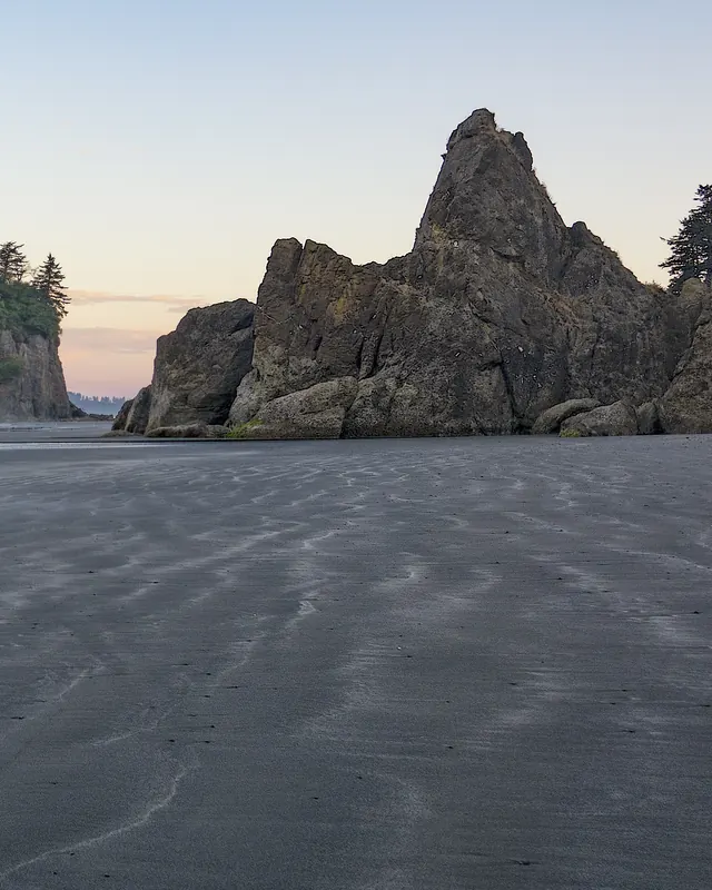
Out past the beach, sea stacks stand where headlands used to be. They belong to the birds now: the rocks and islands off this coast are National Wildlife Refuges.

On the sand, whole trees lie where winter storms left them. Give the drift logs room: one wave can roll them.
Ruby Beach Rialto Beach

A tall sea stack topped with trees stands in the surf at Ruby Beach, in soft dawn light.
Ruby Beach at dawn. John Fowler, CC BY 2.0

2 · The rainforest

140 inches

of rain a year in the Hoh: almost 12 feet

Moss on everything.

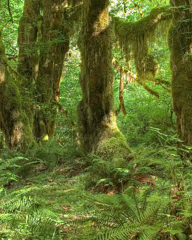
All that rain is why the bigleaf maples wear coats of moss and the sword ferns come up to your waist.

The Olympics wring the clouds out on their way in. About 40 miles away as the raven flies, Sequim sits in their rain shadow and gets about 16 inches.

Hoh Rain Forest Sequim

Bigleaf maples draped in thick green moss over a carpet of sword ferns on the Hall of Mosses Trail.
The Hall of Mosses, Hoh Rain Forest. rachel_thecat, CC BY-SA 2.0
  • Everett
  • Seattle
  • Bellevue
  • Tacoma

3 · The Sound

21 ferries

in the largest ferry system in the United States

Islands, boats and city lights.

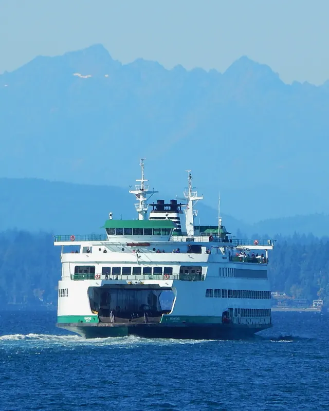
Washington State Ferries carried 20.1 million riders in 2025, between 20 terminals on a Sound with more than 2,500 miles of shoreline. Orcas hunt salmon between the islands.

Long before it was Puget Sound, this water had a Lushootseed name, whulge: the salt water.

Colman Dock Bainbridge Island

A white and green Washington State Ferries boat crosses Puget Sound with the snowy Olympic Mountains behind.
The ferry Wenatchee leaving Seattle. Ron Clausen, CC BY-SA 4.0

4 · The Cascades

14,410 feet

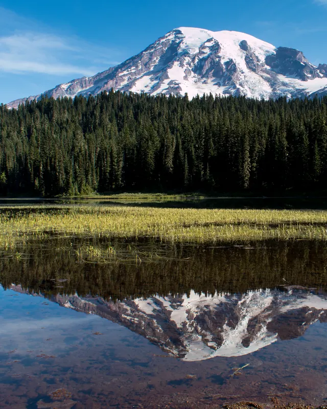
Mount Rainier, the highest peak in the range

Five volcanoes in a row.

Mount Baker, Glacier Peak, Mount Rainier, Mount Adams and Mount St. Helens. Rainier carries 28 major glaciers, more ice than any other peak in the lower 48.

At Paradise, 5,400 feet up its side, about 640 inches of snow fall in an average year, and it can last into July.

Paradise Mount Baker Mount St. Helens

Mount Rainier, white with glaciers, reflected in the still water of Reflection Lakes under a clear sky.
Rainier in Reflection Lakes, July. Cal Wolfe, CC BY-SA 3.0

5 · East of the mountains

8 inches

of rain in a year at Yakima. Seattle gets about 39.

Dry sun and wheat to the sky.

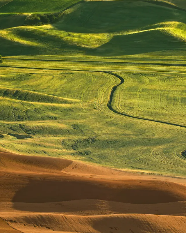
Cross the passes and the clouds run out. The Palouse rolls on in hills of Ice Age dust, blown in on the wind and now some of the richest wheat ground anywhere.

Whitman County alone planted nearly half a million acres of wheat in the last farm census.

Steptoe Butte Yakima

Rolling hills of wheat in green and gold bands stretch to the horizon in low evening light, seen from Steptoe Butte.
The Palouse from Steptoe Butte. Gleb Tarro, CC BY-SA 3.0